Poland's trail marking system is managed primarily by the Polish Tourist and Sightseeing Society (PTTK), which has maintained and signposted routes across the country since the mid-twentieth century. The system uses five colours, each identifying a distinct route rather than a universal difficulty rating.
How the Colour System Works
Each trail colour corresponds to a specific marked route. The same colour can appear on both easy lowland forest paths and steep alpine climbs — the colour itself identifies which route you are on, not how hard it is. Difficulty is communicated through separate written route descriptions and, in mountain areas, through additional signage at trailheads.
Markers are painted directly on trees, rocks, fence posts, and purpose-built marker poles. The standard format is three horizontal bands: a white band, then the route colour, then another white band. In practice, markers are placed frequently enough that losing the trail is unusual on well-maintained routes.
Red Trails
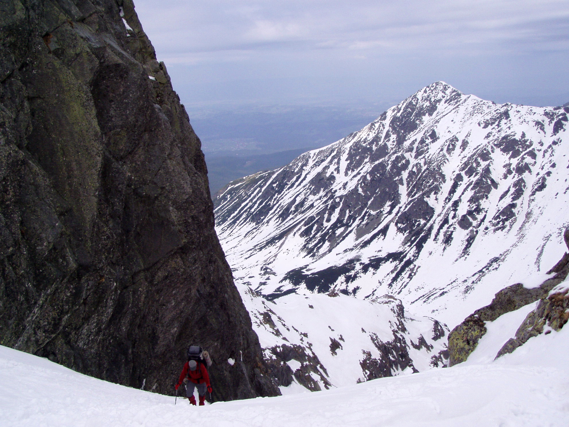
Red marks the primary long-distance routes. In the Tatra Mountains, the red trail follows the main ridge from Kasprowy Wierch to Kościelec and continues across the high peaks. In the Sudeten range, the Main Sudeten Trail (Główny Szlak Sudecki) runs red for its entire length from Świeradów-Zdrój to Prudnik. Red trails in mountain areas are frequently the most demanding.
Blue Trails
Blue trails typically serve as connecting routes between valleys, villages, and main ridge paths. In the Tatra, blue trails ascend valleys like Dolina Chochołowska and approach passes from below. In the Karkonosze mountains, several blue trails provide descent alternatives from the Polish-Czech ridge.
Green Trails
Green is associated with shorter circuits, educational paths, and lowland forest routes. National park educational trails (ścieżki przyrodnicze) are frequently green-marked. In Białowieża and Kampinos, green trails pass through characteristic forest communities with interpretive posts.
Yellow Trails
Yellow trails are typically the shortest in any given area — often linking a village to a nearby viewpoint, or providing a low-level alternative to a ridge route. The Pieniny Mountains' Wąwóz Homole gorge walk is an example of a yellow trail that covers technically interesting terrain in a short distance.
Black Trails
Black marking indicates technically demanding sections, often involving chains, metal rungs, or steep rock steps. In the Tatra National Park, black segments appear on routes involving via ferrata-style passages such as those on Orla Perć (Eagle's Path), one of the most challenging marked routes in Poland. These sections require prior experience and appropriate footwear.
Difficulty in Practice: Mountain vs. Forest
The colour system operates differently depending on terrain type. In mountain parks, trail steepness, altitude, and exposure are the primary difficulty factors — independent of colour. A red ridge trail at 2,000 metres in the Tatra bears little resemblance to a red lowland trail in Mazovia.
In forest parks and lowland areas, all colours tend to indicate easy-to-moderate walking on flat or gently rolling terrain. Białowieża's trails, regardless of colour, involve no significant elevation change. The primary challenge in lowland forest environments is navigation during periods of low visibility and route conditions following heavy rain or snowmelt.
Trailhead Information
Most national park trailheads in Poland carry a printed information board with a route map, distance markers, estimated walking times, and notes on seasonal closures. Times given on these boards typically reflect average walking pace without extended breaks. In practice, rocky or steep sections take longer than the estimate suggests.
Distance and elevation data for major routes across Poland can also be consulted via the PTTK online map service and the national topographic mapping platform at geoportal.gov.pl.
Seasonal Conditions
Mountain trails above the treeline in the Tatra, Bieszczady, and Karkonosze can be impassable or dangerous outside the main summer season without appropriate equipment. Snow can remain on north-facing slopes in the High Tatra until late May or early June. The Tatra National Park may close specific trails temporarily during adverse conditions; announcements are published on their official website.
Forest trails in lowland parks are generally accessible year-round. Winter walking in Białowieża or Kampinos on packed snow is common and can be one of the most rewarding times to visit.